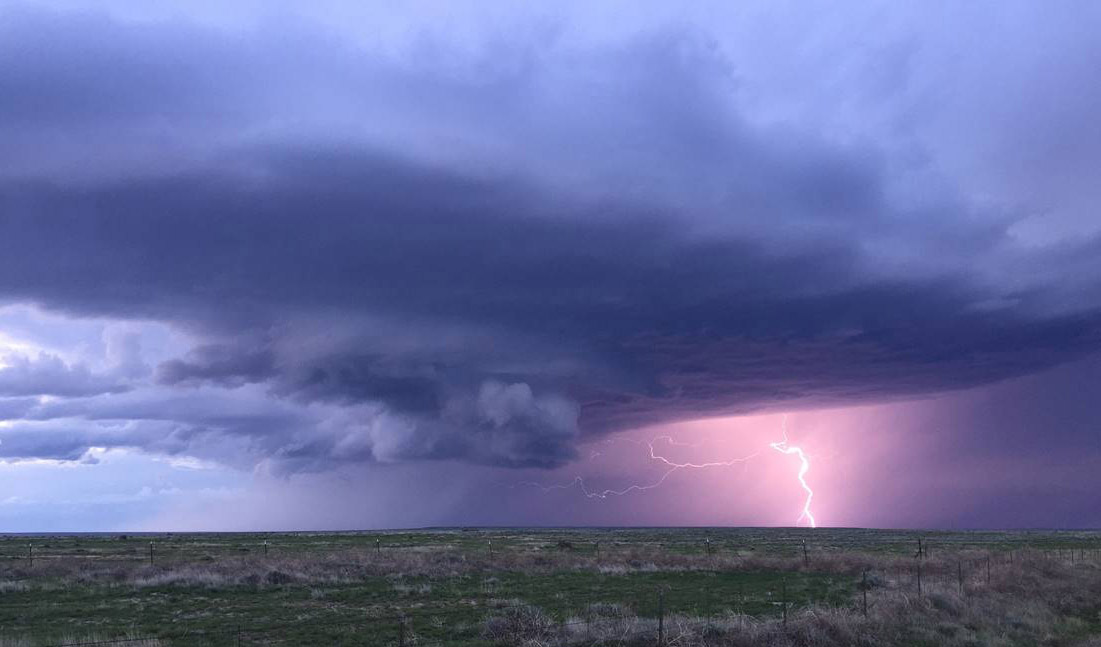
SF State meteorologist lifts the fog surrounding El Niño

Warm waters in the Pacific are responsible for triggering recent thunderstorms, which are unrelated to El Niño, says John Monteverdi, professor of meteorology. When El Niño arrives in December or early January, forecasters predict rain all across the southern tier of the U.S. Photo credit: Professor John Monteverdi
Based on the latest information from a San Francisco State University meteorologist, now may be a good time to stock up on rain ponchos, rubber boots and umbrellas. The overall consensus among scientists, forecasters and tropical meteorologists is that the El Niño weather phenomenon now gathering momentum in the eastern Pacific Ocean will be the strongest recorded since 1950.
And though scientists can never predict the future with absolute certainly, "There has never been an El Niño of this magnitude that didn't produce heavy precipitation in central and southern California," said John Monteverdi, a professor of meteorology at SF State.
Below, Monteverdi discusses some common misconceptions about El Niño, which has been touted as both a savior from California's persistent drought and a scourge that triggers destructive flooding and mudslides.
Myth: El Niño is a storm.
Reality: "The biggest misconception people have about El Niño is that it's a storm, like a hurricane. By definition, El Niño is an oceanographic phenomenon in which ocean temperatures in the eastern tropical Pacific Ocean rapidly rise and cause much warmer than average long-term ocean temperatures, which in turn impact weather patterns," Monteverdi said.
These warmer-than-normal ocean temperatures create pressure patterns in the middle and upper atmosphere, which encourage the development of a strong jet stream over central and southern California, according to Monteverdi. This jet stream is popularly called the storm track, because storms move along it. "If this storm track becomes fixed, we're going to get repetitive, moderate to strong winter storms -- not monster storms, but a lot of them," he said.
During the 1997-98 El Niño, the strongest on record, it rained every day in January, every day in February and almost every day in March. "No one is predicting that it's going to rain every single day, but we are expecting higher than normal precipitation," he said.
Myth: El Niño rains will bring California's water reserves back to normal and end the drought.
Reality: Not exactly. If this year's El Niño occurs as predicted, it will help the state's water resources and it will break the drought in terms of the weather pattern, but not in terms of water resources.
"The reservoirs are so low that we need at least a few years of normal rainfall beyond this year to get our resources back to normal," Monteverdi explained. "It will take two years if we have 60 inches of rain this year and 60 inches next year."
With that said, El Niño has been seen to more than double the rainfall in some areas. During the 1997-98 El Niño, San Francisco measured nearly 50 inches of rain -- normal rainfall measured 23 inches. Likewise, Los Angeles, with an average rainfall of 15 inches, has seen up to 40 inches of rainfall during strong El Niño years, Monteverdi said.
Myth: More flooding events occur in California because of El Niño.
Reality: Nope. It turns out the major flooding in California normally occurs with something called atmospheric rivers, which tend to develop in non-El Niño years, said Monteverdi. These so-called rivers cause heavy rainfall and then go away as quickly as they appeared. Monteverdi noted that in December of 2014, "We had a spectacular event with heavy rainfall, and then it shut off. We had nothing in January, February and March."
However, coastal flooding and mudslides could occur during El Niño when high winds and high tides combine with heavy rainfall, he said.
Myth: The warm water off the California Coast is a product of El Niño.
Reality: Not necessarily, Monteverdi says.
The warm coastal waters have actually been around for about three years. "Usually when we have an El Niño developing we do see warm water along the coast here, but our coastal water is not coming from the tropics [where the El Niño forms]. The warm water develops locally because there's less upwelling," Monteverdi explained. Upwelling is a phenomenon that occurs along the West Coast during the summer that brings cold water up to the surface of the ocean. The atmospheric pressure patterns have reduced upwelling so coastal water temperatures are warmer. This has been referred to as "the blob" in the popular press.
Myth: El Niño is caused by global warming.
Reality: No. El Niño is part of the climatological record and has been around forever, Monteverdi said. "Even without global warming, we'd have El Niño patterns once in a while. Today, the issue is that climate change scientists say it will become more frequent and more intense due to global warming," he added.